Lyderhorn
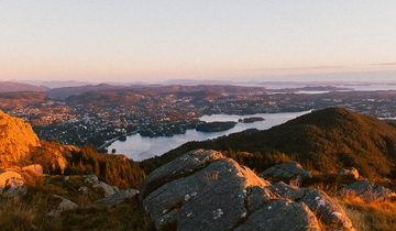
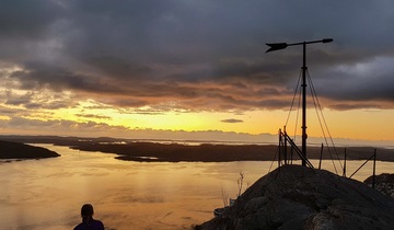
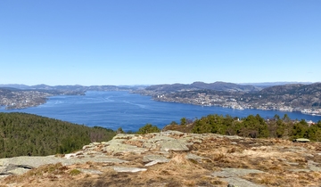
Lyderhorn (396 m) is the westernmost of Bergen’s seven mountains. The mountain can be reached from different directions, and at the top you will have a glorious 360 degrees view of Bergen and beyond.
Facts and fiction about Lyderhorn
- Elevation: 396 meters
- Hike duration: depends on where you start. From 1 – 2 hrs.
- Track: footpath, hiking trail
- Difficulty level: medium
- According to folklore, Lyderhorn was the place where witches gathered on Walpurgis night. The last person to be accused of witchery in Bergen in 1590, Anne Pedersdotter, was said to have flewn to Lyderhorn on her broom stick to join the ceremony
About Mount Lyderhorn
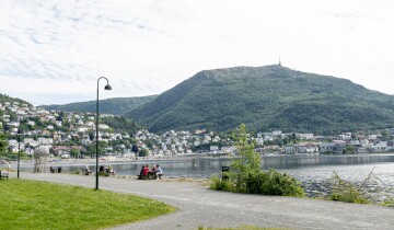
Mount Lyderhorn is situated some kilometers west of the city center of Bergen. The elevation is 396 meters. You can expect spectacular view from the top. Lyderhorn is the first mountain of the 7- mountains hike, and fits perfect for hiking beginners.
During your hike, you may also want to take the time to visit Kvarven, a military fort, located north of Lyderhorn. Kvarven was a strategically important fort during WWII. Now Kvarven is part of a recreational area and is an open air war memorial. Lyderhorn is therefore both a historical site and a mountain with an incredible 360 degree view of Bergen and surrounding areas.
Need to rent outdoor equipment?
There are places you can rent equipment for free or a small fee
How to get to Mount Lyderhorn
Lyderhorn is the mountain furthest away from the city center, and it is therefore best to travel to Lyderhorn by bus. You can search for the best transit options for you on the Skyss Travel Planner. There are mulitple options for getting to Mount Lyderhorn, depending on where you would like to start:
Option 1: Getting to Lyderhorn from Gravdal/Laksevåg (North-East)
The hike is easy at the start, and steeper near the top.
This hike has a trail the entire way and can be up to 2.5 km round trip. It is estimated to take about 2 hours to hike and the elevation gained is around 300 metres.
- Take the bus from the city center to “Gravdal” bus stop.
- Follow the road to the NUTEC-institute.
- Pass through the short tunnel, and continue on the gravel road.
Option 2: Getting to Lyderhorn from Loddefjord/Kjøkkelvik (West)
This is the steepest and shortest trail to Lyderhorn.
- Take the bus from the city center to “Loddefjord terminal”. From there you can either walk 15 minutes before you get to the hiking trail, or catch nus number 45 to Skålevik and stop at “Kjøkkelvik skole”.
- If you decide to walk, follow the road north from the terminal, walk to Kjøkkelvik school and go up the street named Lyderhornslien.
- The trail to Lyderhorn is signposted.
Option 3: Getting to Lyderhorn from Skålevik/Kjøkkelvik (West)
This path to Lyderhorn is located close to the second option, but is at the same time longer and less steep. This route also has a designated parking lot if you travel here by car.
- Take the bus from the city center to “Loddefjord terminal”. From there you can either walk 30 minutes before you get to the hiking trail, or catch another bus to “Skålevik”. We recommend taking the bus to Skålevik Snuplass, as it is a long walk to the starting point for pedestrians.
- Once you are here, follow the forest path that leads up to Lyderhorn.
Parking spots close to Lyderhorn
If you travel by car, you can either park in the parking lot in Skålevik, the local Rema 1000 or Kjøkkelvik school. Gravdal also has some parking spots, but significantly fewer than Kjøkkelvik.
Safe hiking in Norway
Stay safe and get the most out of hiking in the Norwegian nature.